(click on image for full view)
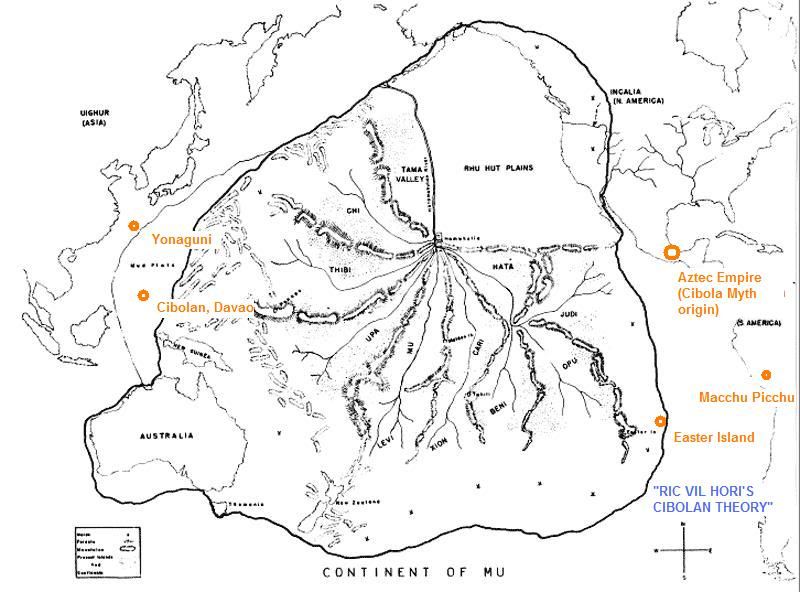
The map is based on possible location of Mu/Lemuria during the Paleozoic Era around 250 Million years ago, and prior to Continental Drift of the land mass Pangaea. Massive Geological changes occurred through the Ages that eventually became the present locations of modern maps, with the archipelago of Maharlika / Philippines that ultimately formed as remnant of ancient Motherland MU / Lemuria approx. 60-50 Million years later through the Geological process of Subduction.
No comments:
Post a Comment